
Trust the experts for high- profile, fast-track projects
Quality GPS services achieving centimeter accuracy
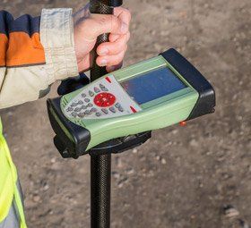
NAVTech Inc. is known as an authority on both traditional and state-of-the-art GPS surveying techniques. With Leica Dual Frequency GPS Equipment, we are able to achieve centimeter accuracy in both FastStatic and Real-time modes.
All of our key personnel have proven experience in the establishment of horizontal and vertical site control, aerial control, construction surveys and the completion of metes and bounds and topographic surveys. Call 717-582-7735.
Get the benefits of state-of-the-art GPS technology
- It's faster, more accurate, more detailed
- Provides latitude and longitude so everything can be converted to state plain coordinates
- Permanent location of utility lines both overhead and underground
- Provides information to create profiles and horizontal views of utility lines
- Determine lease layouts, boundaries, easements, and right-of-ways